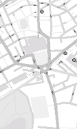
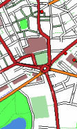
Vector Maps vs Raster Maps
Benefits of Vector Maps
Smaller Tile Filesizes makes web download faster/cheaper. A basic test of Central London (bounding box 51.45 51.57 -0.23 -0.05) uses 1218 Raster maps (zoom 16 PNG files from OSM website) totalling 12.7Mb. The same coverage in Vector maps (vector zoom 9 - roughly equivalent in detail to raster zoom 16) uses 132 tiles, totalling 2.2Mb.
Smoother Zooming - maps can be infinitely zoomed without loss of quality/aliasing defects, etc.
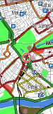
Maps can be rotated/tilted. The vector maps can be drawn on the Plan, Navigation, Route and Visualisation pages - the 3D screens now have a real benefit in being able to rotate the map in the direction of travel.


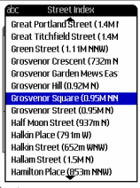
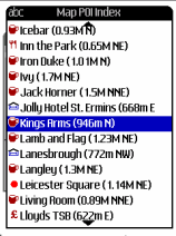
Tile Metadata - place names, street names, etc are stored within the tile allowing a local gazetteer to be easily displayed.
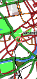
Choice of Map Styles - since the maps are rendered on-the-fly, the style can be customised or simplifed to improve screen refresh times. Night mode can also now gives a proper white-on-black viewing mode.
Drawbacks with Vector Maps
Slow Screen Drawing - the vector maps put quite a strain on the phones graphics functions and so some handsets perform much better than others.
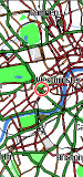
Difficulty in Reducing Data at Lower Zooms - when zooming out on a raster map smaller features will just getter smaller and smaller until they disappear, without affecting filesize or redraw times. However, with vector maps as you zoom out a decision has to be make as to which features should be included, as the more features there are, the larger the file and slower the screen-draw times. For example, at what point should residential roads be hidden? Or post-boxes, or lakes, or railway stations, etc. This trade-off becomes more and more difficult the more the map is zoomed out, so currently only zoom levels 7-10 are displayed.
Text Rendering - Java/J2ME has very basic character-drawing functions, only allowing horizontal text in a limited number of sizes/styles. Therefore it is difficult to draw roadnames and other labels in the same style as on raster tiles, so instead each road has a small marker, which, when scrolled over will highlight the road or point-of-interest and display its name. (In fact in some ways this can be an advantage as it prevents the phones screen from becoming too cluttered with lots of writing, which is often too small to read on a mobile anyhow!)

